

(Trips further afield at bottom)
Bicycle Day Trips in Countryside Around Ōtautahi Christchurch
In recent decades, like many cities around the world, Christchurch has successfully constructed a major network of dedicated cycle paths and delineated cycle lanes. These have been a boon to increasing numbers of both commuter and recreational cyclists.
In Christchurch, the substantial and ongoing construction of the cycle infrastructure is changing the mindset of people towards using this healthy and environmentally friendly form of transport. Cycling within the city has become safer and more enjoyable.
As elsewhere, the development and availability of e-bikes have accelerated the trend in cycle use. E-bikes have enabled many in the community to get out, socialize, exercise, and explore the city and countryside. What could be better?
In addition to the intra-city cycle network the country districts around Christchurch now have a wide range of scenic cycle routes both dedicated and along “country lanes”.
The videos below are of examples of day trips beyond the city and show animated GPS traces, with pop-up photographs to illustrate the routes and the varied paths, scenes and landscapes. Where possible, the routes chosen give priority to using cycle paths, tracks and back roads.
Generally the distances shown are based upon the start and finish points being on the perimeter of St Albans suburb.
For viewing the videos on mobile phones it is recommended to maximize each video to full screen landscape mode. Site constraints have meant that the videos are reduced in resolution from the original 4K. If you prefer background music while viewing the videos un-mute each video.
Comments or questions may be submitted at the bottom of the page.
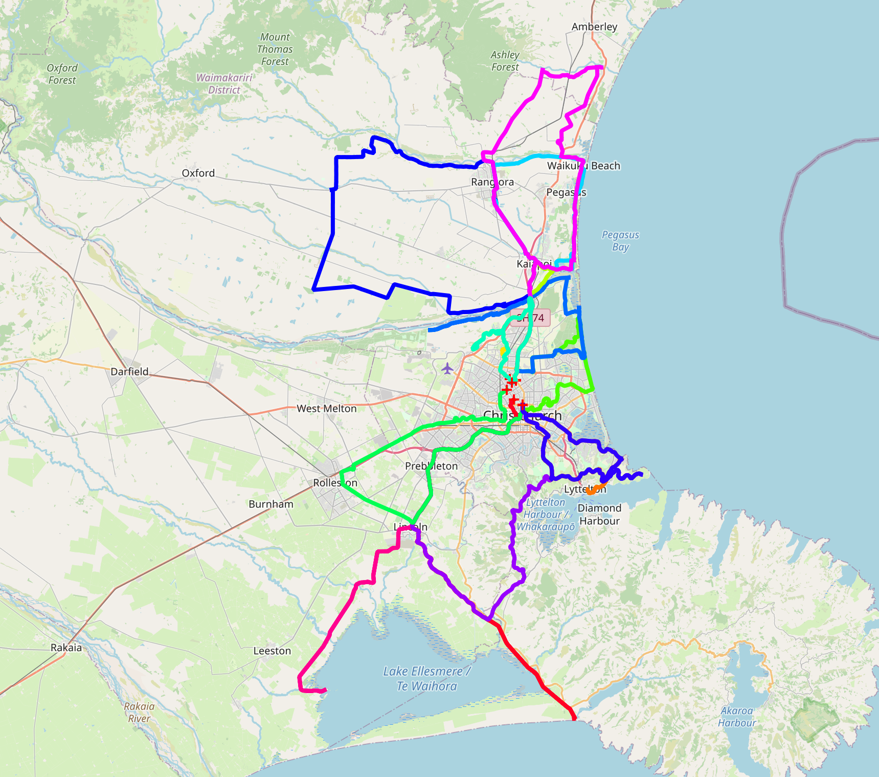
Day Trips
- Leithfield Loop
- Kairaki Waikuku Rangiora Loop
- Ashley River Rakahuri Upper Return
- Brooklands McLeans Island Loop
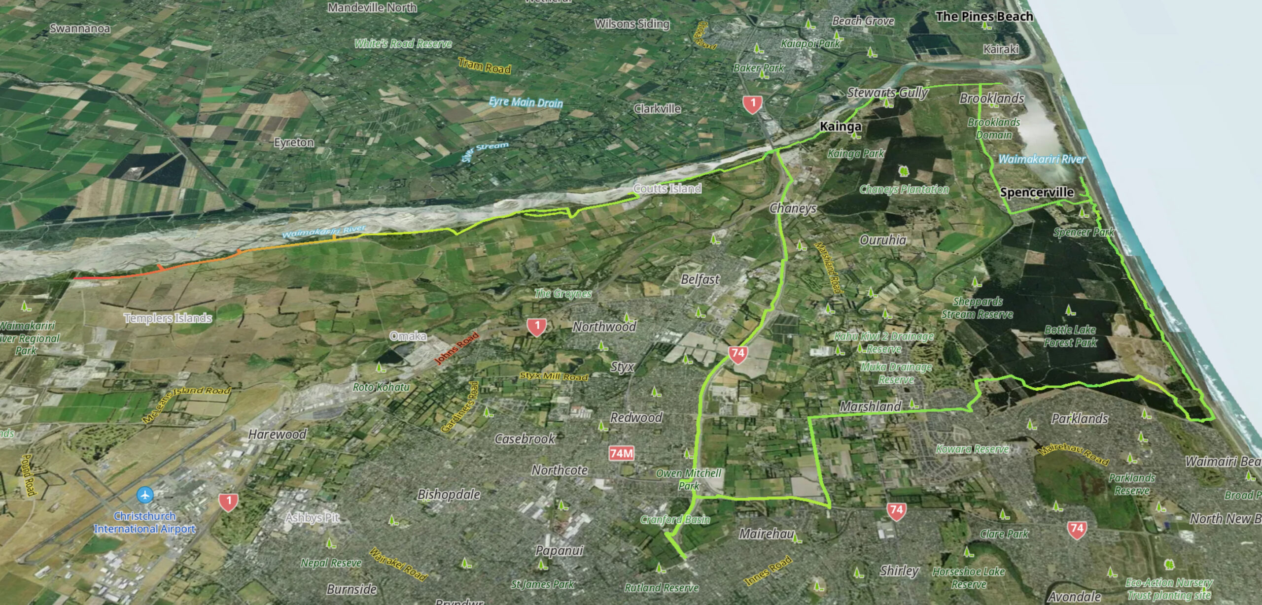
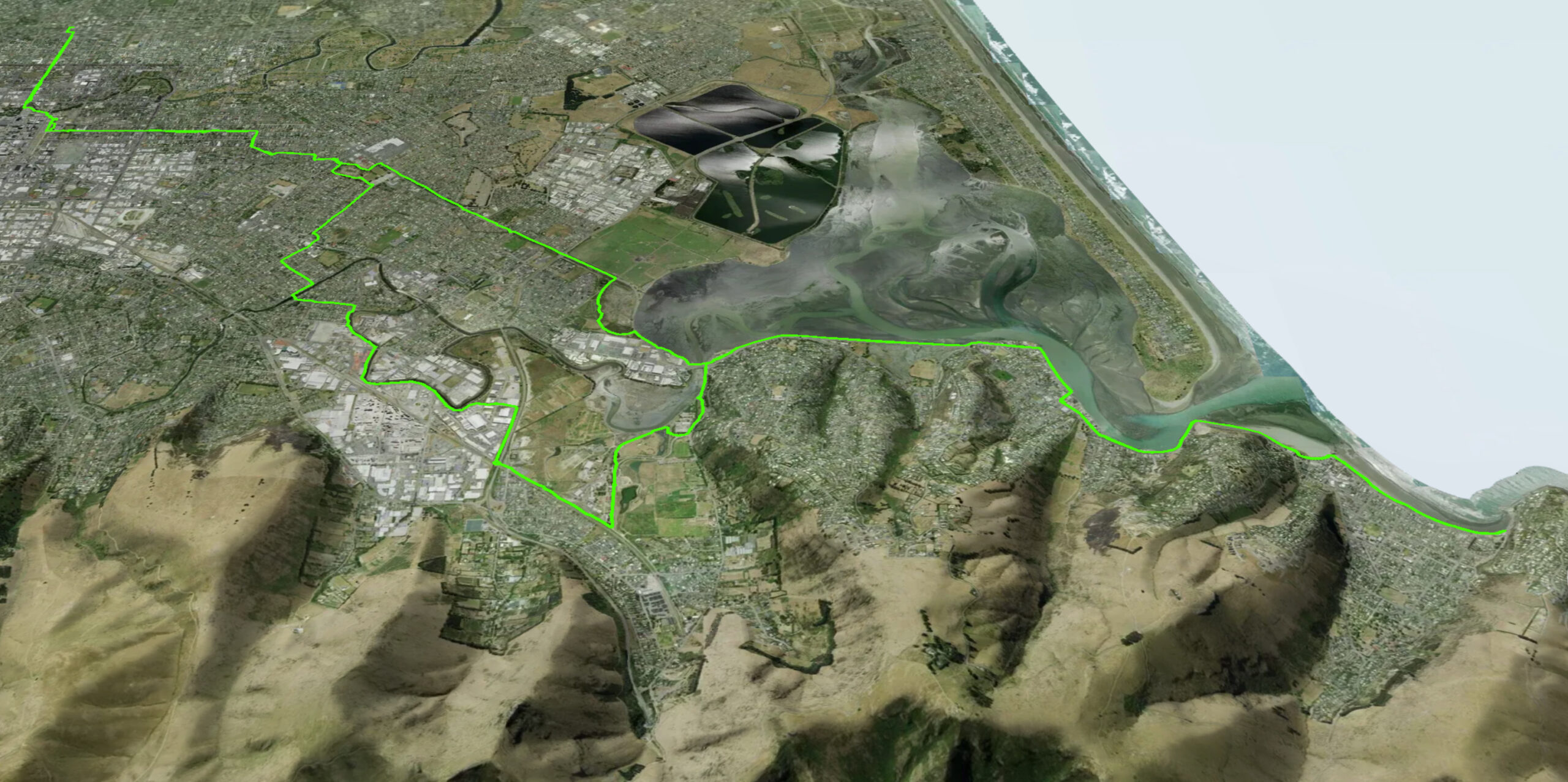
- Bottle Lake and Avon River Ōtākaro Loop
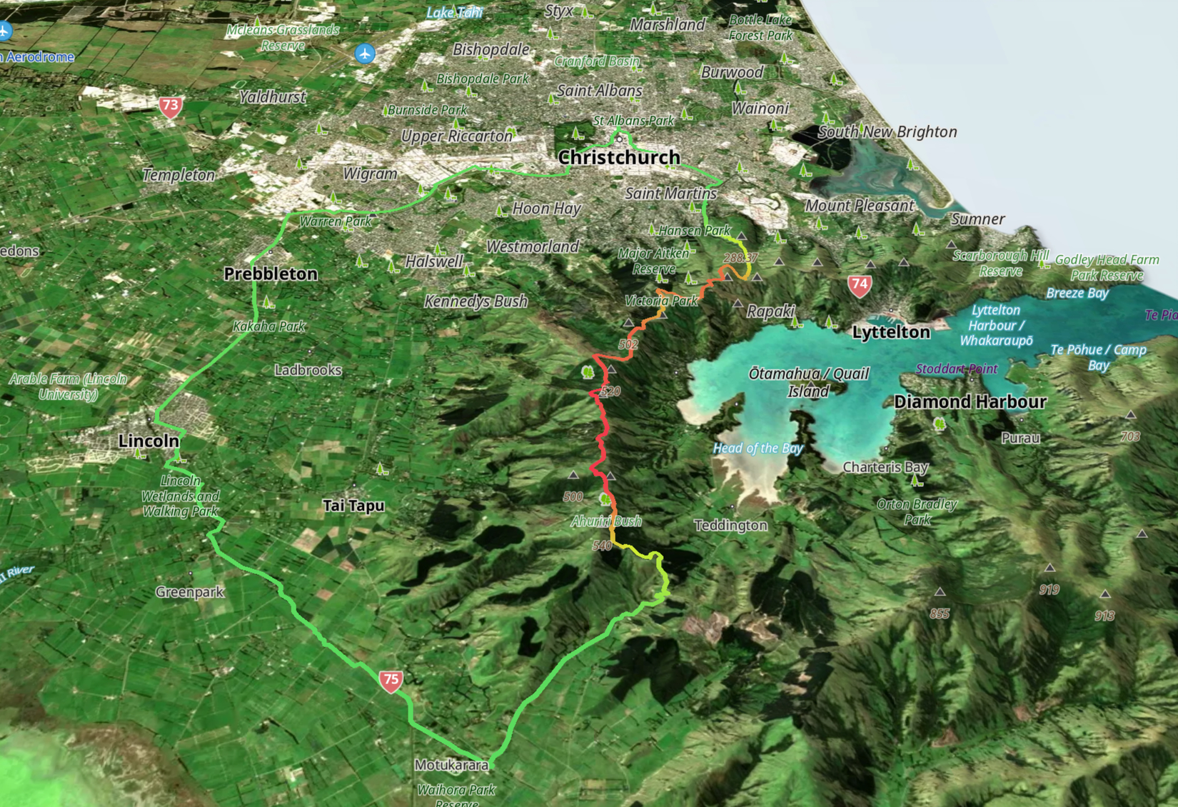
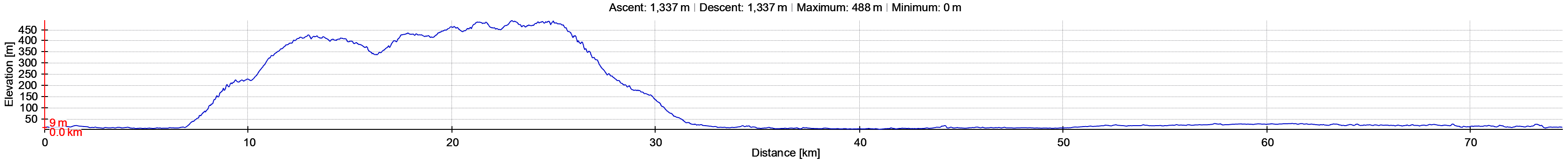
- Rapaki Lyttelton Sumner and Godley Loops
- Rapaki Gebbies Loop
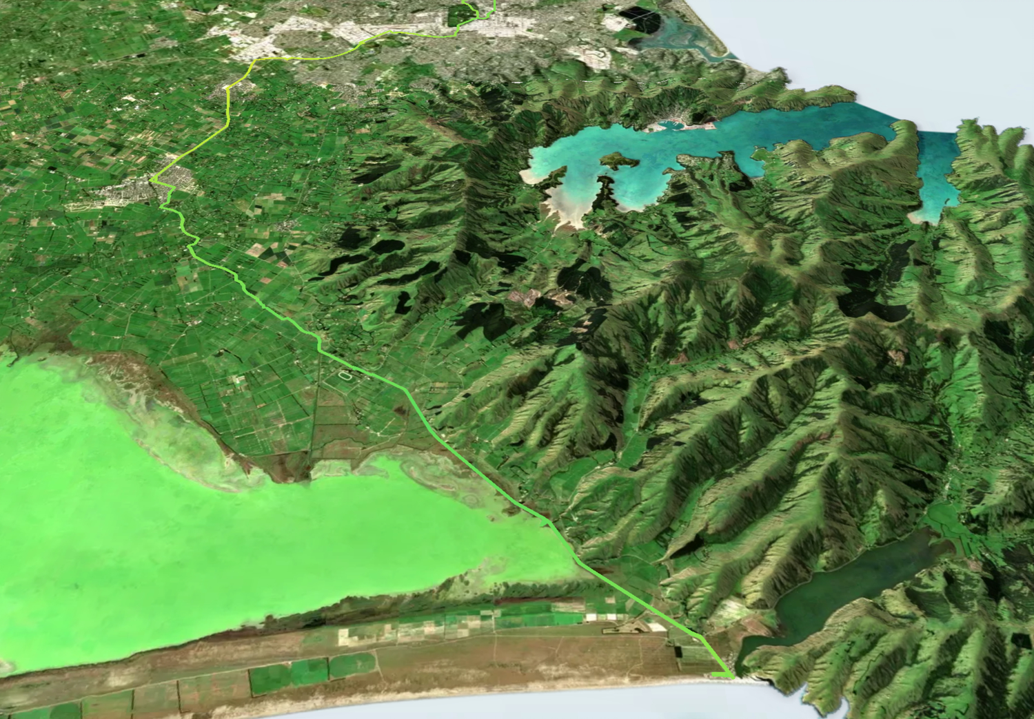
- Coes Ford – Lake Ellesmere Te Waihora Return
- Birdlings Flat Return
- Otukaikino Loop
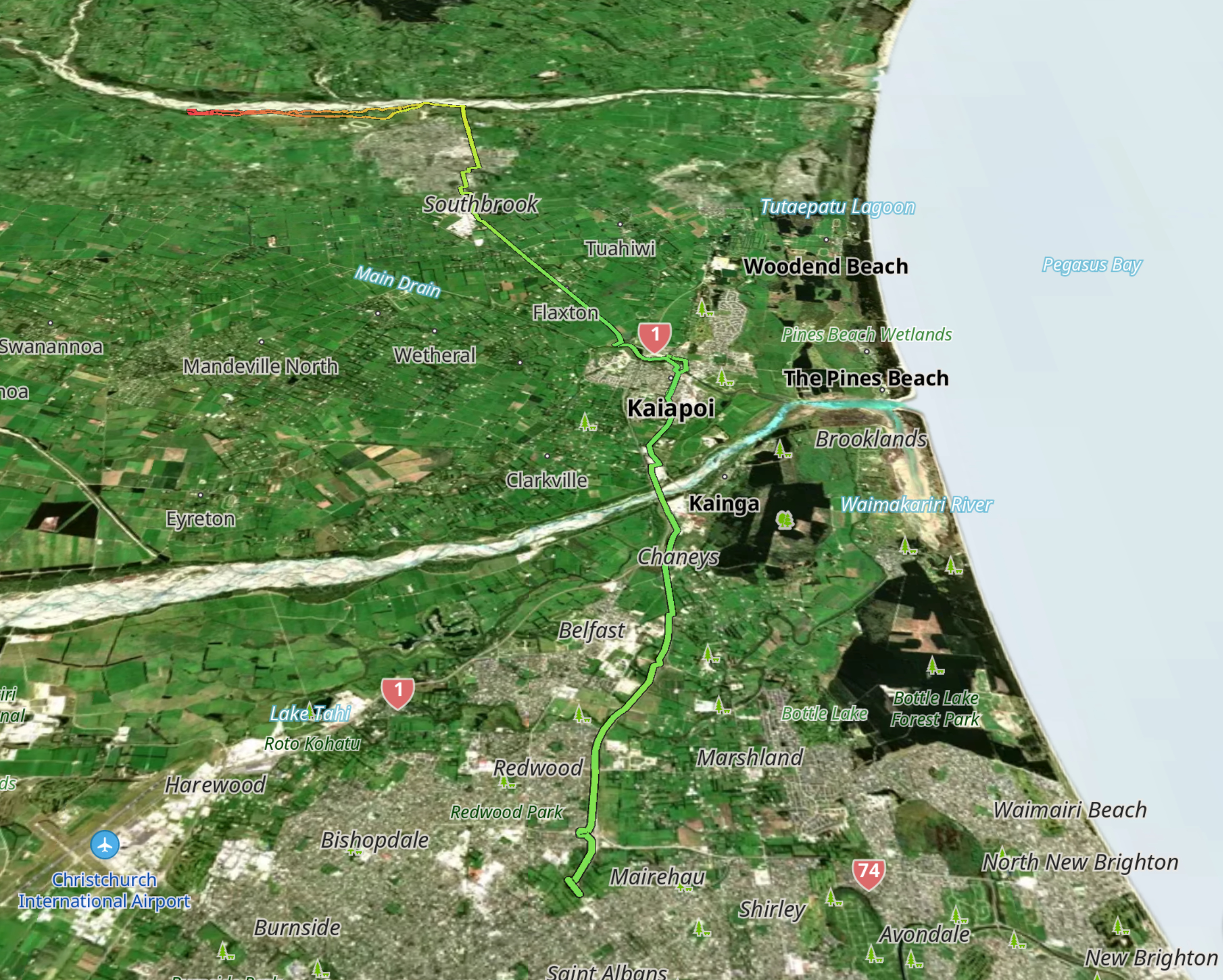
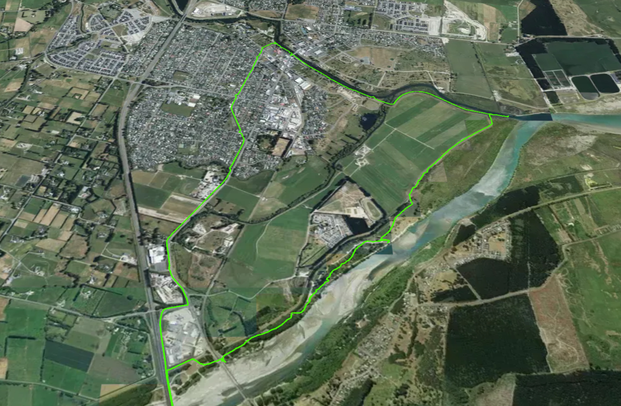
- Kaiapoi Triangle
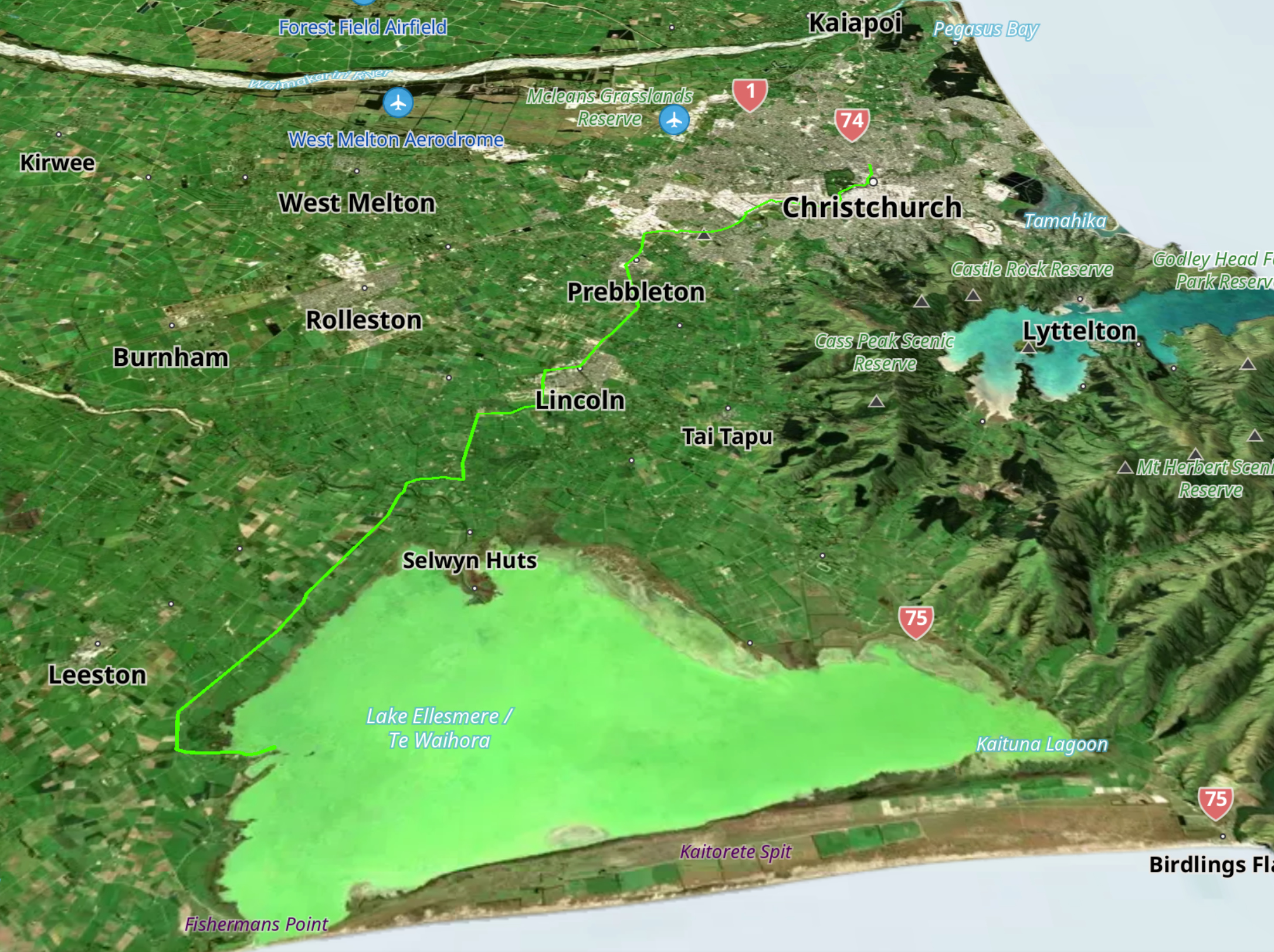
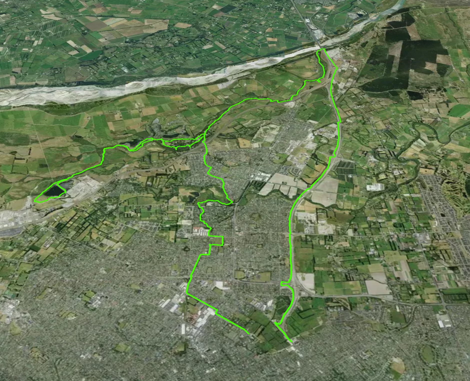
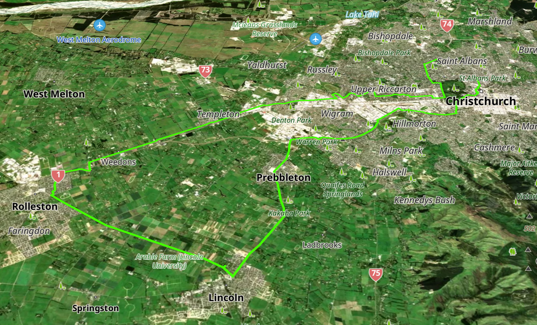
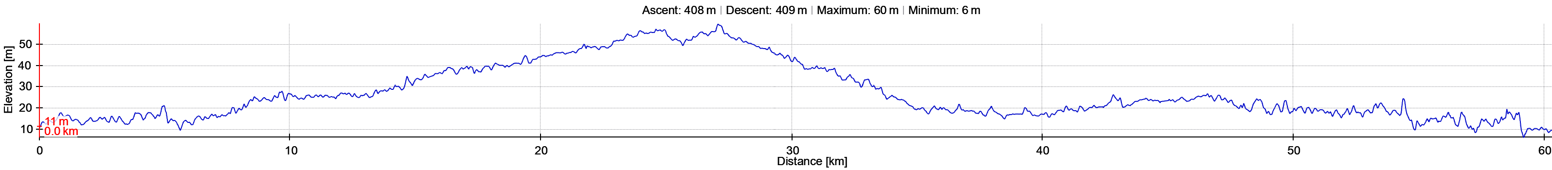
- Rolleston Lincoln Loop
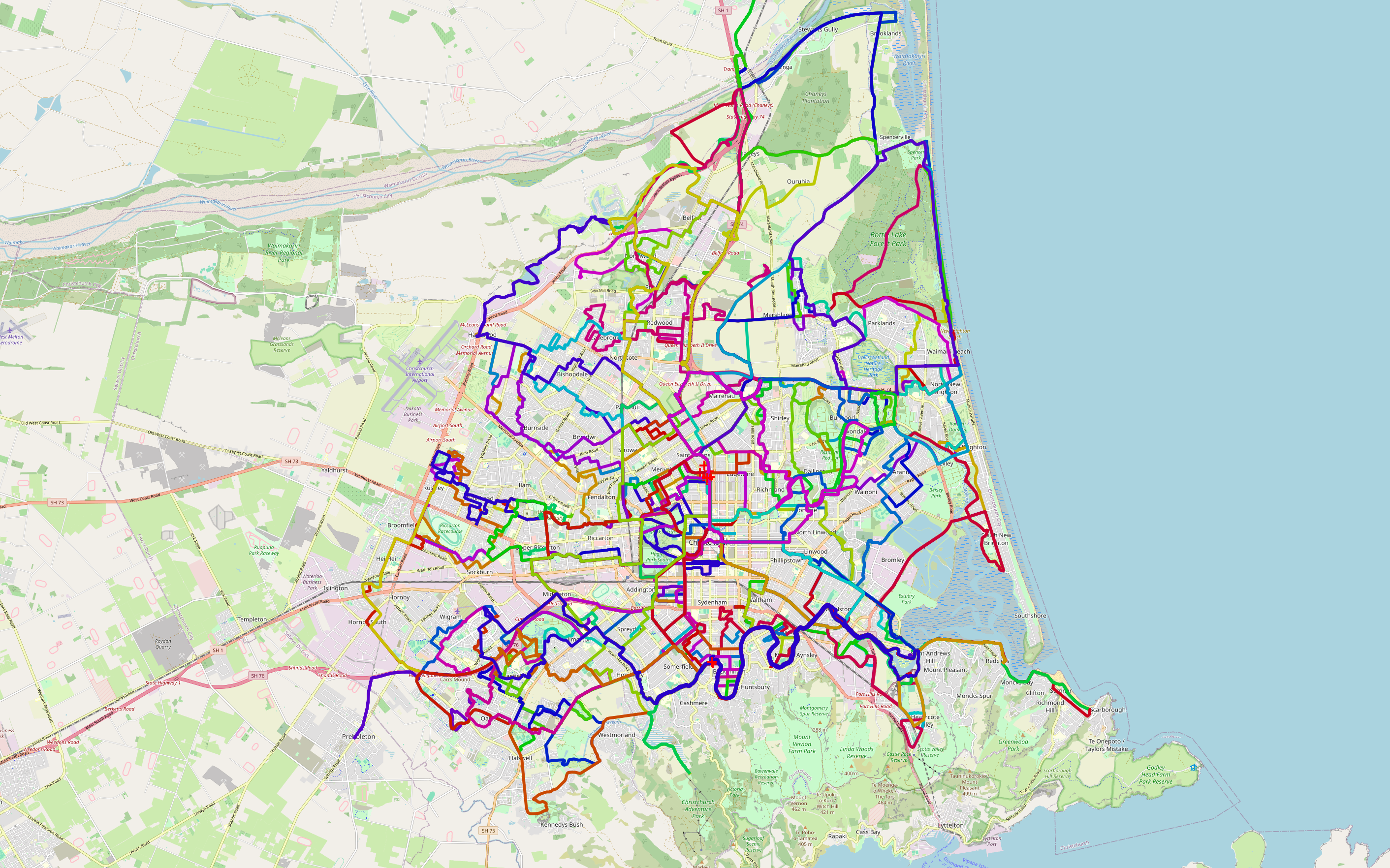
Cycling Within The City
Cycle Path Network
Wednesday Wheelies Group
Further Afield
Day Trips
Leithfield Loop
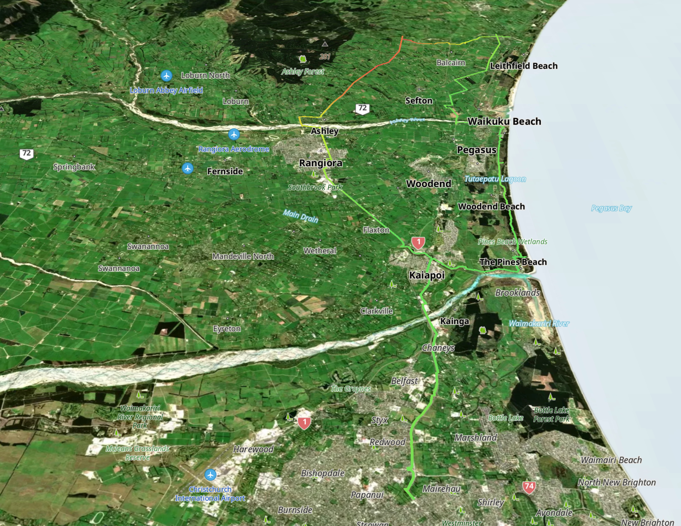
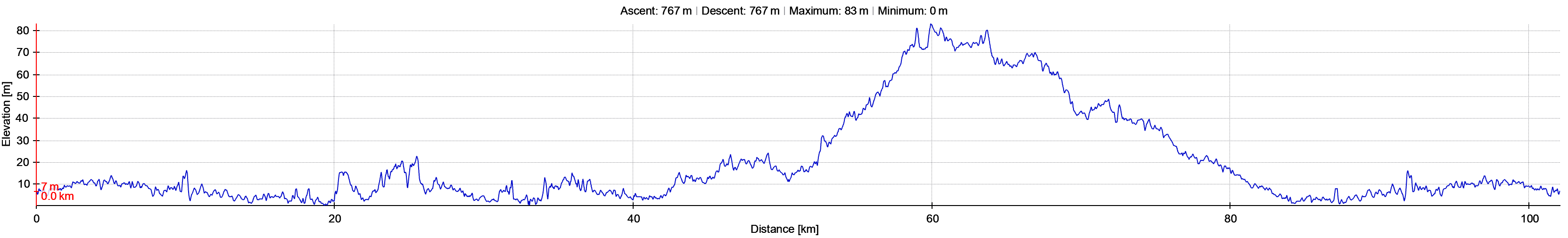
Download above track as a GPX file (right button click on link and select “Save Link As”).
Kairaki Waikuku Rangiora Loop
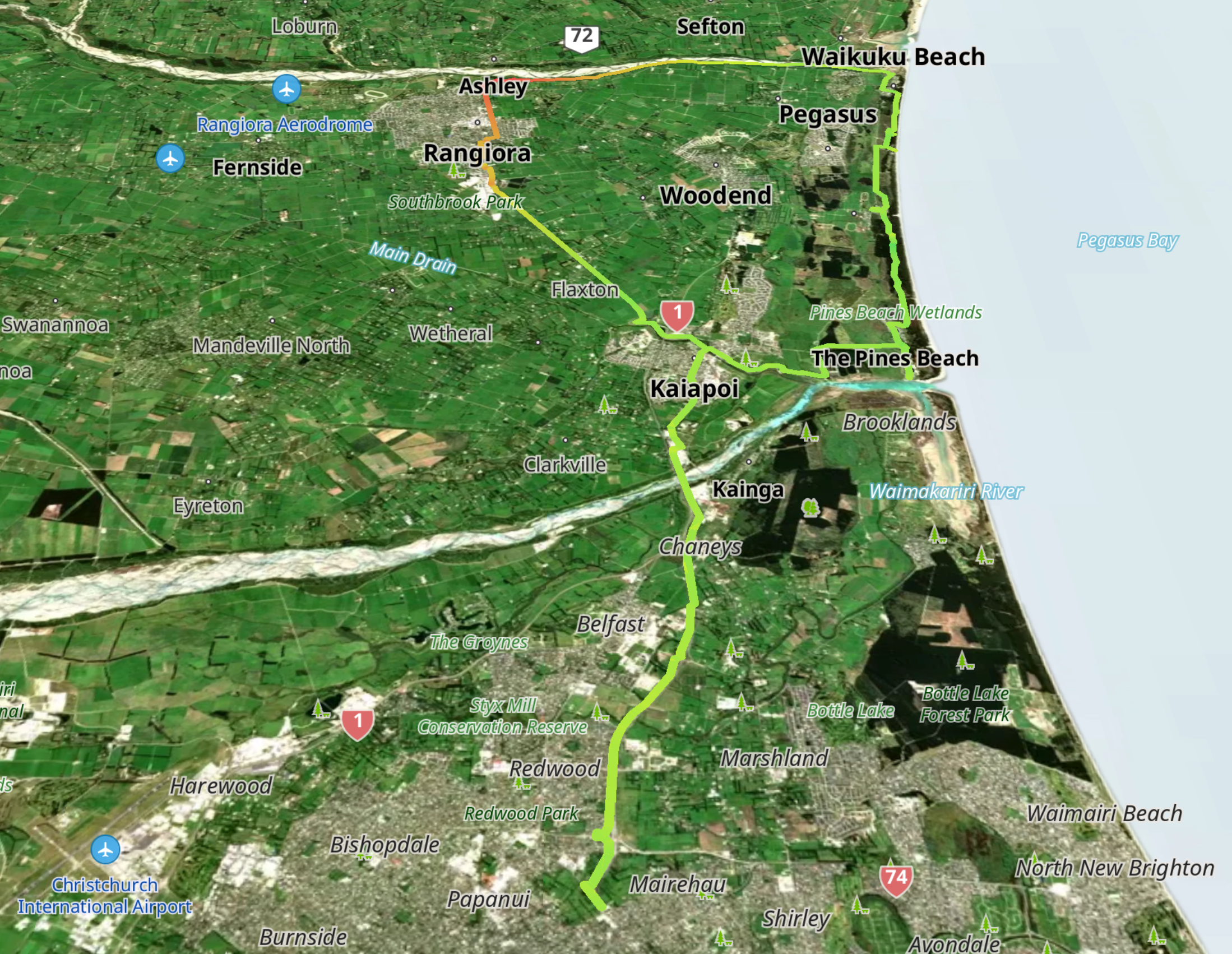
Download above track as a GPX file (right button click on link and select “Save Link As”).
Ashley River Rakahuri Upper Return
Download above track as a GPX file (right button click on link and select “Save Link As”).
Brooklands McLeans Island Loop
Download above track as a GPX file (right button click on link and select “Save Link As”).
Bottle Lake and Avon River Ōtākaro Loop
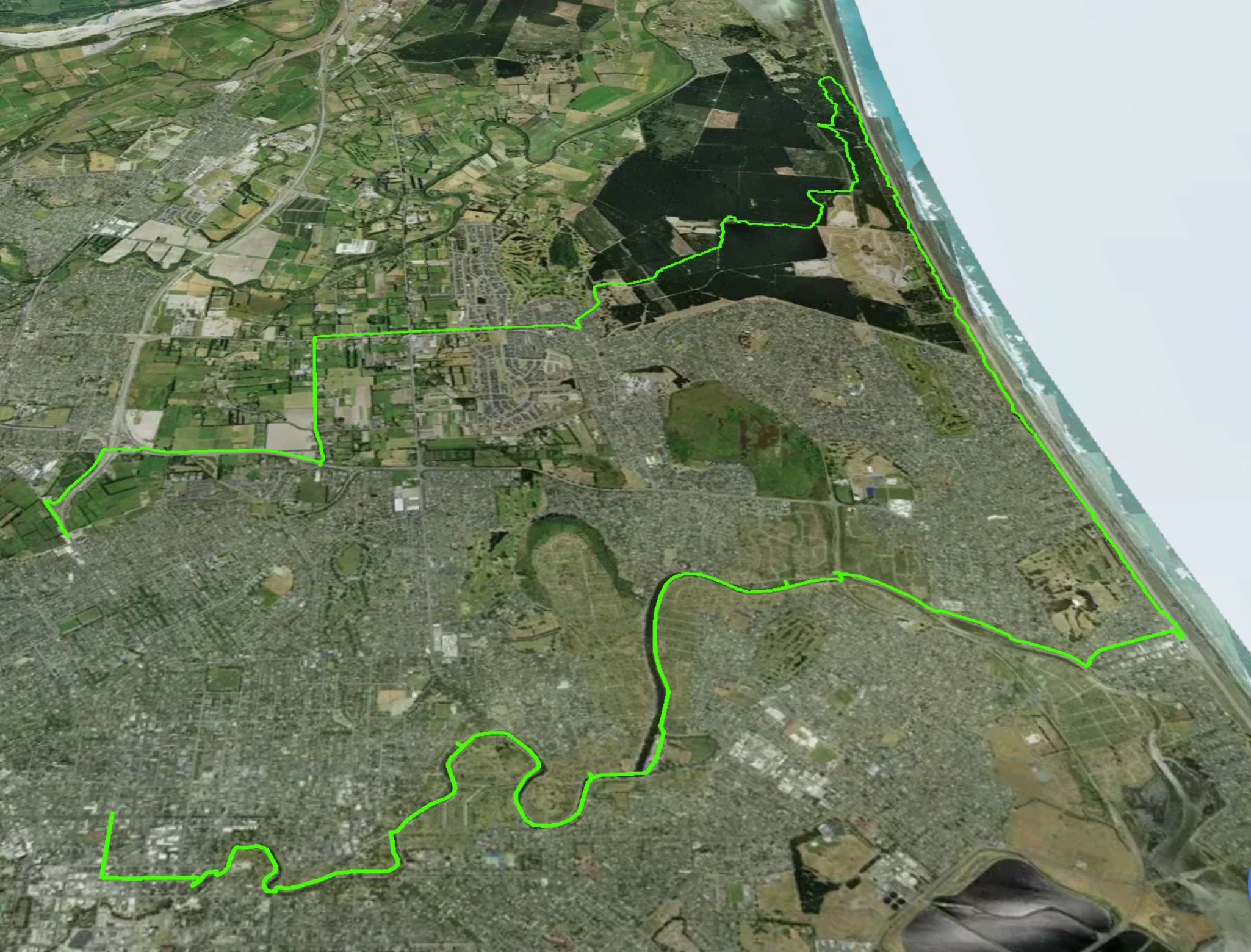
Download above track as a GPX file (right button click on link and select “Save Link As”).
Rapaki Lyttelton Sumner and Godley Loops
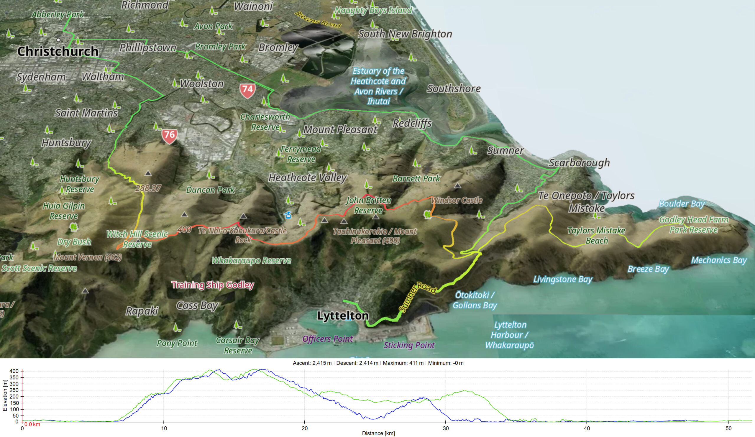
Download above track as a GPX file (right button click on link and select “Save Link As”).
Rapaki Gebbies Loop
Download above track as a GPX file (right button click on link and select “Save Link As”).
Coes Ford – Lake Ellesmere Te Waihora
Download above track as a GPX file (right button click on link and select “Save Link As”).
Birdlings Flat via LRRT Return
Download above track as a GPX file (right button click on link and select “Save Link As”).
Otukaikino Loop
Download above track as a GPX file (right button click on link and select “Save Link As”).
Kaiapoi Triangle
Download above track as a GPX file (right button click on link and select “Save Link As”).
Rolleston Lincoln Loop
Download above track as a GPX file (right button click on link and select “Save Link As”).
Cycling Within The City
Cycle Path Network
A playlist of videos promoting the network of dedicated cycle paths within the city are hosted by Spokes Canterbury and may be viewed at this channel on Youtube
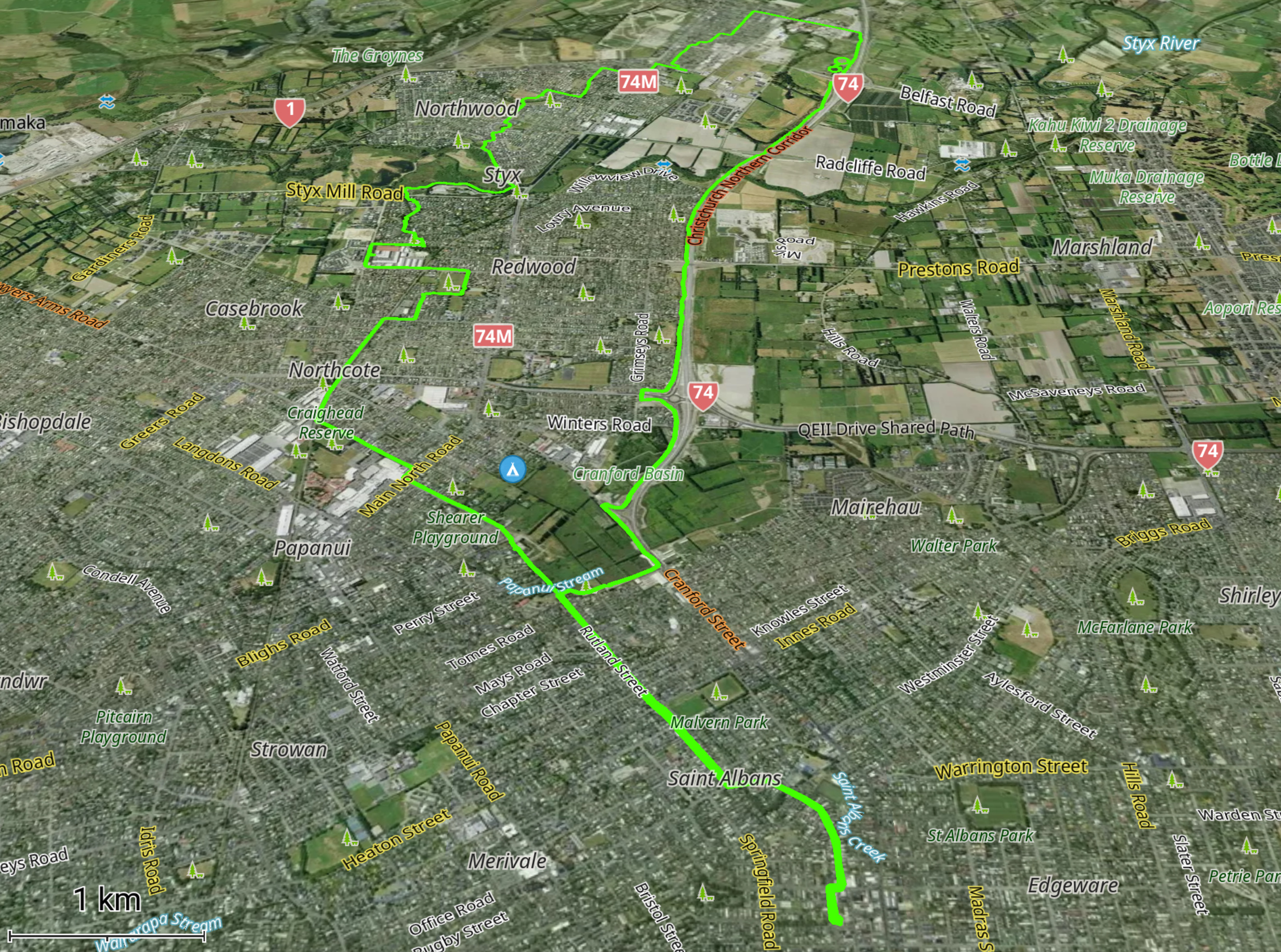
Wednesday Wheelies Cycling Group
The Wednesday Wheelies is an informal community cycling group based in the suburb of St Albans. The group originated in 2017 and, since then, has grown rapidly in numbers and ride options, mainly within the city limits. Each Wednesday, groups of riders follow one of the more than 200 custom designed rides which cover the city, exploring interesting, quirky and less frequented places.
Two examples of these rides, “#5 Heathcote Sumner” and “#52 Belfast Northwood”, are shown below.
WW Heathcote Sumner Loop
WW Belfast Northwood Loop
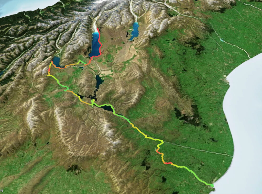
Trips Further Afield
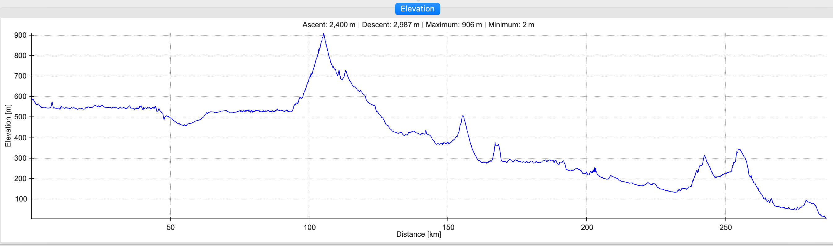
The Alps to Ocean Cycle Trail (March 2020)
The spectacular A2O is New Zealand’s longest continuous cycle trail. It stretches from the Southern Alps (near Aorangi Mt Cook) south east to the coastal town of Oamaru. Around lakes, across the Mackenzie Basin and down the Waitaki valley. The trail is 300km long, more or less depending upon chosen starting point.
The trip was with a group of friends. Our starting point was the north eastern corner of Lake Pukaki.
The landscape speaks for itself.
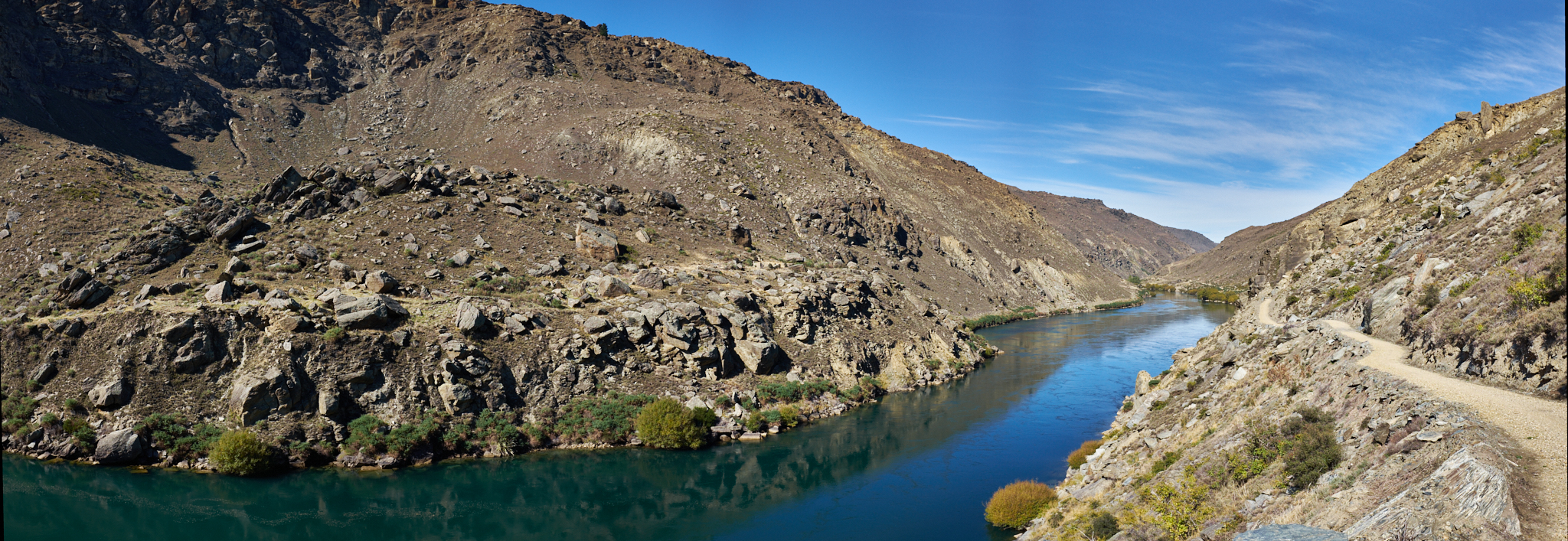
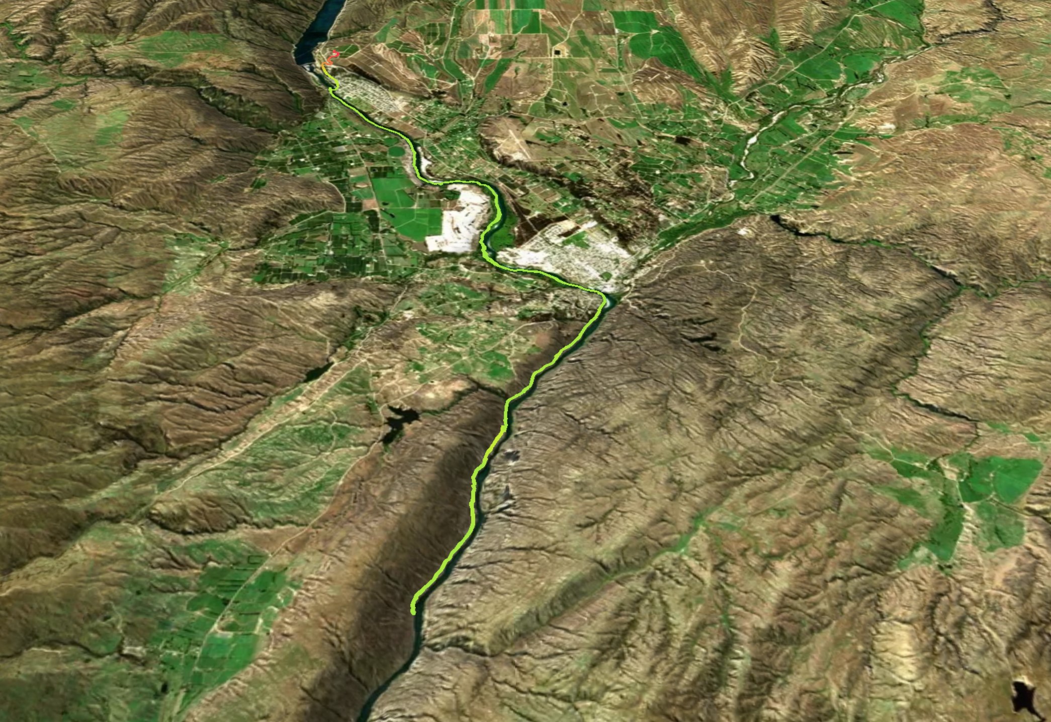
Central Otago – Clyde to Roxburgh Gorge (March 2017)
Semi-arid Central Otago is located in the lower central region of the South Island. The spectacular landscape featured in the video is characterized by barren schist outcrops, contrasting dramatically with the blue/green deep waters of the Clutha River.
Copyright © Peter S Harris, 2026
Activation of comments